The next stage of my journey will bring me from Cyprus to continental part of Turkey. My destination will be
Adana airport
LTAF.
Since I will be flying over the sea, I have to fill a flight plan.
(FPL-FGRT2-VG
-PC6T/L-FGOUV/A
-LCGK1300
-N0117F050 3542N3434E/N117F045 3612N3456E ADA
-LTAF0140 LTAG
-0)
Once validated by IFPS, I can focus on the airport charts. Unfortunately, I couldn't find any documentation about
Gecitkale. Thus I focus on
LTAF at
Adana. The active runway is 09, so I will carry out a direct departure to the East.
Then I will fly to the North-East end of the island to cross the sea at the shortest and reach the shores of Turkey. Then I will follow the coast until I'm close to
LTAF.
To land I decided to follow VOR 1 landing chart. As far as I understood, I had to go right over the ADA VOR (112.7) at 3000 ft then turn to the 206° for 2 minutes. Next step is to turn right to intercept 51° radial and descend to 2500 ft and wait to be at 7.5 nm from the airfield to start descending on final. It looks easy except that I have no clue on how I will determine when I will be 7.5 nm far from the runway.
I will use
LTAG Incirlik airport as a divert landing site in case of problem. Both are really close from one another.
Concerning fuel, I start with the amount I had at the end of the previous flight : 135 gal.
 |
| Ready to take-off |
 |
| Leaving Gecitkale |
After take-off, I immediately climb to 5500 ft heading 52° to follow the island until it's far end. It is also time to train using that propeller lever. Once on cruise condition, I reduce use it to my RPM and watch the torque grow as a consequence. During all this phase, throttle is left at around 85% which is marked green on the tachometer.
 |
| Turning point |
24 minutes later I'm on my turning point. A look at my fuel gauge tells me I'm still good : 130 gal. So I turn left to face the sea. As I'm now flying to the 310° I have to descend to 4500 ft.
 |
| Over the sea |
From Cyprus island I can see the shores of Turkey which is quite comfortable in deed. After a short 27 flight, I reach the coast.
 |
| Arriving in Turkey |
I'm quite earlier than scheduled on my turning point but it is not a problem. I still have 125 gal, much more than required to reach
Adana or
Incirlik. I'm now intercepting the 49° radial of ADA VOR which will bring me directly to the airport. I'm descending to 3500 ft to fit the even and odd altitude requirements.
 |
| Along the coast |
I can now take some time to have a look at the traffic airplanes around :
 |
| AI traffic |
 |
| AI traffic |
Suddenly the weather turns a bit stormy and I have to descend to 1500 ft to avoid being to close to the clouds.
 |
| Under de clouds |
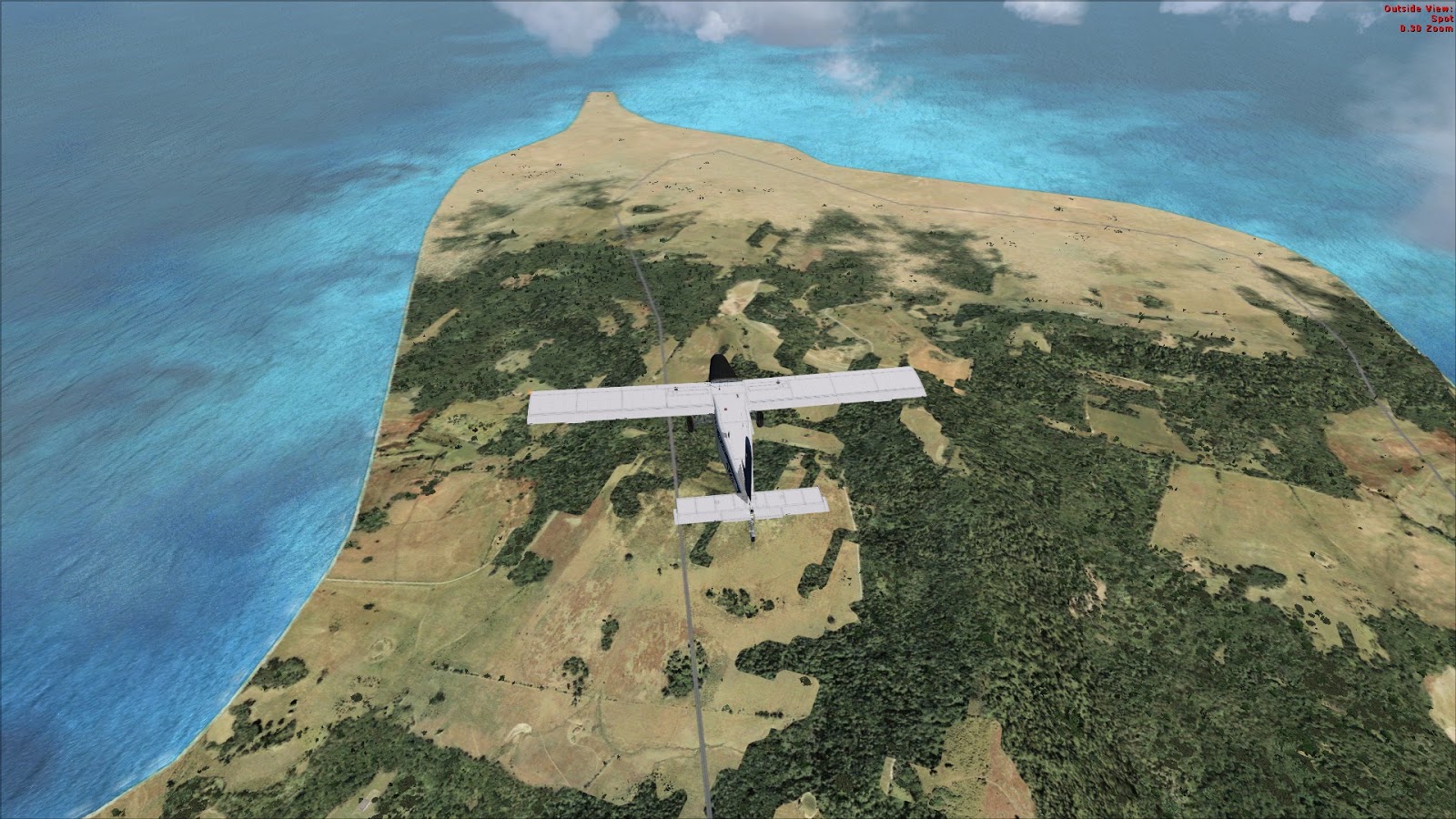
Finally I cross the shore line which indicates I'll be soon over the VOR beacon.
 |
| Crossing the shore line |
A few minutes later, I can see my HSI flipping from To to From, telling me I'm right over the beacon. Now it's time to turn right to the 206° and to descend to 2500 ft. 2 minutes later, I turn again on the right to intercept the 49° radial which will lead me directly to the final leg.
 |
| On final |
After a really short landing, I taxi to the general aviation parking and stop my engine.
 |
| Taxi at LTAF |
This was quite a good flight for me. I never had doubt about my navigation, I was on time on my waypoints and I finally managed to handle that propeller lever.
 |
| Flight map |


No comments:
Post a Comment