Saturday, March 21, 2020


Sunday, November 24, 2019
Monday, October 15, 2018
Discount on any Steam product
I can offer a 25% discount on any Steam product.
Please send me a message at clemgrt76@gmail.com
Or on the Facebook page of this Blog
Please send me a message at clemgrt76@gmail.com
Or on the Facebook page of this Blog
Friday, March 23, 2018
Sorry for the break
I know it has been a while since I haven't written an article there. But I am quite busy at work, and I spend some of my spare time developing an application that runs on Android : Memory des Nombres
It is a game based on the Memory designed to help young children (between 4 and 8) to learn reading numbers... Yet it might be quite challenging for grown ups too. Do not hesitate to check it out and try to rank at the first place ;)
It is a game based on the Memory designed to help young children (between 4 and 8) to learn reading numbers... Yet it might be quite challenging for grown ups too. Do not hesitate to check it out and try to rank at the first place ;)
Thursday, February 22, 2018
[FSX] Pilatus PC6 Porter : Through Turkey (Part. 1)
The next stage of my journey will bring me from Cyprus to continental part of Turkey. My destination will be Adana airport LTAF.
Since I will be flying over the sea, I have to fill a flight plan.
(FPL-FGRT2-VG
-PC6T/L-FGOUV/A
-LCGK1300
-N0117F050 3542N3434E/N117F045 3612N3456E ADA
-LTAF0140 LTAG
-0)
Once validated by IFPS, I can focus on the airport charts. Unfortunately, I couldn't find any documentation about Gecitkale. Thus I focus on LTAF at Adana. The active runway is 09, so I will carry out a direct departure to the East.
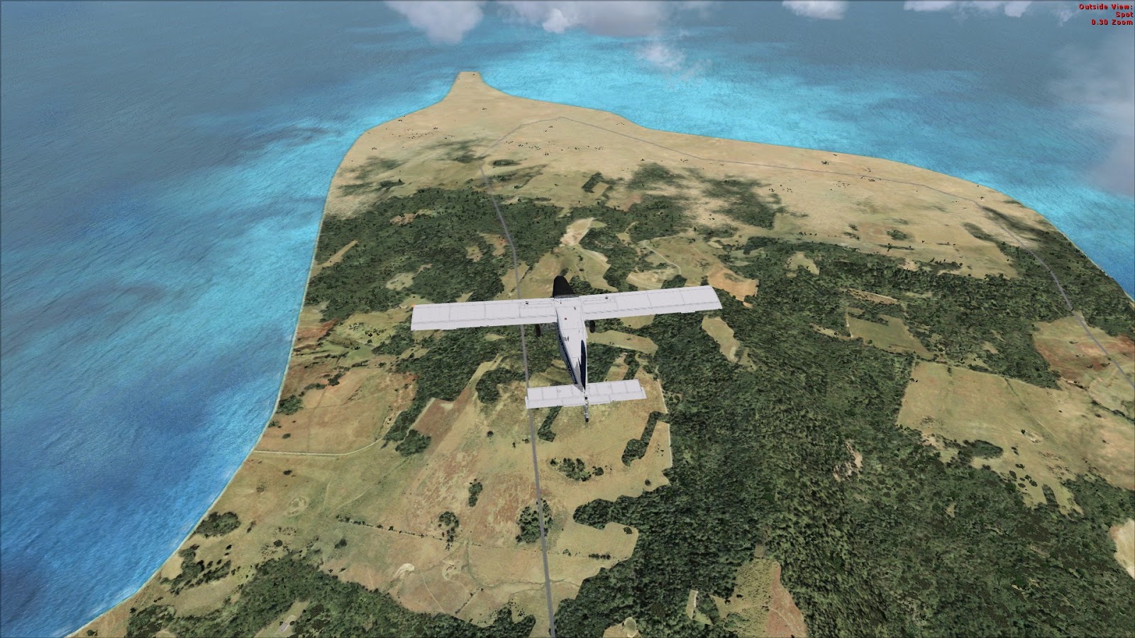
Then I will fly to the North-East end of the island to cross the sea at the shortest and reach the shores of Turkey. Then I will follow the coast until I'm close to LTAF.
To land I decided to follow VOR 1 landing chart. As far as I understood, I had to go right over the ADA VOR (112.7) at 3000 ft then turn to the 206° for 2 minutes. Next step is to turn right to intercept 51° radial and descend to 2500 ft and wait to be at 7.5 nm from the airfield to start descending on final. It looks easy except that I have no clue on how I will determine when I will be 7.5 nm far from the runway.
I will use LTAG Incirlik airport as a divert landing site in case of problem. Both are really close from one another.
Concerning fuel, I start with the amount I had at the end of the previous flight : 135 gal.
After take-off, I immediately climb to 5500 ft heading 52° to follow the island until it's far end. It is also time to train using that propeller lever. Once on cruise condition, I reduce use it to my RPM and watch the torque grow as a consequence. During all this phase, throttle is left at around 85% which is marked green on the tachometer.
24 minutes later I'm on my turning point. A look at my fuel gauge tells me I'm still good : 130 gal. So I turn left to face the sea. As I'm now flying to the 310° I have to descend to 4500 ft.
From Cyprus island I can see the shores of Turkey which is quite comfortable in deed. After a short 27 flight, I reach the coast.
I'm quite earlier than scheduled on my turning point but it is not a problem. I still have 125 gal, much more than required to reach Adana or Incirlik. I'm now intercepting the 49° radial of ADA VOR which will bring me directly to the airport. I'm descending to 3500 ft to fit the even and odd altitude requirements.
I can now take some time to have a look at the traffic airplanes around :
Suddenly the weather turns a bit stormy and I have to descend to 1500 ft to avoid being to close to the clouds.
Finally I cross the shore line which indicates I'll be soon over the VOR beacon.
A few minutes later, I can see my HSI flipping from To to From, telling me I'm right over the beacon. Now it's time to turn right to the 206° and to descend to 2500 ft. 2 minutes later, I turn again on the right to intercept the 49° radial which will lead me directly to the final leg.
After a really short landing, I taxi to the general aviation parking and stop my engine.
This was quite a good flight for me. I never had doubt about my navigation, I was on time on my waypoints and I finally managed to handle that propeller lever.
Since I will be flying over the sea, I have to fill a flight plan.
(FPL-FGRT2-VG
-PC6T/L-FGOUV/A
-LCGK1300
-N0117F050 3542N3434E/N117F045 3612N3456E ADA
-LTAF0140 LTAG
-0)
Once validated by IFPS, I can focus on the airport charts. Unfortunately, I couldn't find any documentation about Gecitkale. Thus I focus on LTAF at Adana. The active runway is 09, so I will carry out a direct departure to the East.
Then I will fly to the North-East end of the island to cross the sea at the shortest and reach the shores of Turkey. Then I will follow the coast until I'm close to LTAF.
To land I decided to follow VOR 1 landing chart. As far as I understood, I had to go right over the ADA VOR (112.7) at 3000 ft then turn to the 206° for 2 minutes. Next step is to turn right to intercept 51° radial and descend to 2500 ft and wait to be at 7.5 nm from the airfield to start descending on final. It looks easy except that I have no clue on how I will determine when I will be 7.5 nm far from the runway.
I will use LTAG Incirlik airport as a divert landing site in case of problem. Both are really close from one another.
Concerning fuel, I start with the amount I had at the end of the previous flight : 135 gal.
 |
| Ready to take-off |
 |
| Leaving Gecitkale |
 |
| Turning point |
 |
| Over the sea |
 |
| Arriving in Turkey |
 |
| Along the coast |
 |
| AI traffic |
 |
| AI traffic |
Suddenly the weather turns a bit stormy and I have to descend to 1500 ft to avoid being to close to the clouds.
 |
| Under de clouds |
 |
| Crossing the shore line |
 |
| On final |
 |
| Taxi at LTAF |
 |
| Flight map |
Monday, February 19, 2018
[FSX] Pilatus PC6 Porter : On the road again (Part 2)
Now it's time to go for the first step of my travel to the next theater... As scheduled, this first flight will take me from Akrotiri LCRA to Gecitkale LCGK.I will follow a VFR flight plan along the shores of Cyprus.
As the weather changed since the last flight, the active runway is now 28.
When in the air, I follow the left hand circuit to rejoin the sea and start my navigation.
As the weather changed since the last flight, the active runway is now 28.
 |
| Ready to take-off on runway 28 |
 |
| Downwind leg |
I leave the airbase at 08:07 and climb to 9,500 ft as I head to the 56° to reach the VOR beacon LCA. I should be on it at 08:27.
 | |
| Flying along the coast. |
A few minutes later, I can see Larnaca airport on my left.
 |
| Larnaca in sight |
Still a few minutes to fly and I'm proud to see that I am be precisely on time over my turning point. My remaining fuel is 150 gal which is very good too.
 |
| Over Larnaca |
It is the occasion to have a look at the AI traffic thanks to World of AI
 |
| AI traffic on parking |
 |
| Aegean airline in flight |
Now I can turn left to follow the 14° radial which will make me follow the coast.
Then after a few minutes, I have to turn right to follow the 88° course. And after a 20 minutes flight I turn right again to the 325°. Thus I have to descend to 8,500 ft to fit the VFR altitude rules (Even South West).
Another few minutes later, I see my destination airfield on my right.
 |
| Destination in sight |
As it is a non controlled airfield, I just announce myself and my intending to land there. Thanks to the good weather conditions and the clear picture of the airfield I decide to enter directly in final leg and land at once.
 |
| Landed at Gecitkale. |
I touch the ground at 09:00 with a few minutes late. I still have 140 gal in my tank. It should be enough for the next flight. I stop the plane and shut it down before the next flight...
 |
| My flight plotted on the map |
Today was quite an easy flight yet I still had trouble managing the throttle and the power lever. This is going to be the main axis of work of the following sessions.
Friday, February 16, 2018
[FSX] Pilatus PC6 Porter : On the road again (part 1)
With the new year comes the time to take off again after this 3 months long break. The plan for the following flights is to close the Falcon BMS chapter to open a brand new one.
Yet I need first to travel to a new theater. Thus the first flight will be a VFR navigation from Akrotiri LCRA to Gecitkale LCGK . This will bring me from the Greek part of Cyprus to the Turkish one. In the near future, I will have to cross that country to go to my final destination.
In order to make this flight more enjoyable, I will follow the coast line.
To carry out this flight, I will dust my old Pilatus PC6 Porter by Tim "Piglet" Conrad.
Obviously I will have to train a bit before going on travel with this plane. So I will start with remembering the check-lists, then I will carry out some circuit training and finally fill my tank up and leave for Gecitkale airfield.
First step in this training is to familiarize again with the check-lists of this plane. It has been a while since I haven't flown the PC6, I almost have to restart from the beginning.
My reference is still the document written by Scott Werner and available here.
Fortunately the Pilatus is really easy to handle and to fly and there are not too much systems to deal with. It should be long before I am able to fly it again...
After a short training, I have no difficulty in starting up the engine and taxiing to the runway threshold.
Circuit at Akrotiri LCRA on runway 10 is right handed and should be flown at 1200 ft QFE.
Once aligned on the runway, I slowly push the throttle to full and then release the brake. The plane starts rolling as I keep the yoke full aft until 25 kts. Then I slowly release it. Decision speed is 45 kts and rotation 50 kts.
Once leaving the ground, I briefly press the brake to stop the wheels rolling. At 500 ft, I bring the flaps up and trim to keep on climbing at around 80 kts and 950 ft/m.
I check engine instruments perform the climb-out check-list.
Once at 1200 ft and above the sea, I turn right to enter downwind leg.
A quick rest and it is already time to carry out the approach check-list. Decelerating from 90 kts to 70 kts.
Landing speed is around 70 kts .
Once on the ground I push the throttle forward again and take-off for another circuit. In the same conditions.
Below is the record of my two circuits. Easy to see where the wind blows from...
After landing again, I leave the runway and taxi to the refuel station to fill my gaz tank up so as to be ready for the next flight...
Yet I need first to travel to a new theater. Thus the first flight will be a VFR navigation from Akrotiri LCRA to Gecitkale LCGK . This will bring me from the Greek part of Cyprus to the Turkish one. In the near future, I will have to cross that country to go to my final destination.
In order to make this flight more enjoyable, I will follow the coast line.
To carry out this flight, I will dust my old Pilatus PC6 Porter by Tim "Piglet" Conrad.
Obviously I will have to train a bit before going on travel with this plane. So I will start with remembering the check-lists, then I will carry out some circuit training and finally fill my tank up and leave for Gecitkale airfield.
1 - Check lists
First step in this training is to familiarize again with the check-lists of this plane. It has been a while since I haven't flown the PC6, I almost have to restart from the beginning.
My reference is still the document written by Scott Werner and available here.
Fortunately the Pilatus is really easy to handle and to fly and there are not too much systems to deal with. It should be long before I am able to fly it again...
 |
| Pilatus PC6 |
2 - Circuit training
Circuit at Akrotiri LCRA on runway 10 is right handed and should be flown at 1200 ft QFE.
Once aligned on the runway, I slowly push the throttle to full and then release the brake. The plane starts rolling as I keep the yoke full aft until 25 kts. Then I slowly release it. Decision speed is 45 kts and rotation 50 kts.
Once leaving the ground, I briefly press the brake to stop the wheels rolling. At 500 ft, I bring the flaps up and trim to keep on climbing at around 80 kts and 950 ft/m.
I check engine instruments perform the climb-out check-list.
 |
| Climbing out |
 |
| Downwind leg |
Landing speed is around 70 kts .
Once on the ground I push the throttle forward again and take-off for another circuit. In the same conditions.
Below is the record of my two circuits. Easy to see where the wind blows from...
 |
| Circuit training record |
 |
| Refueling |
Subscribe to:
Posts (Atom)